100 words - day 12
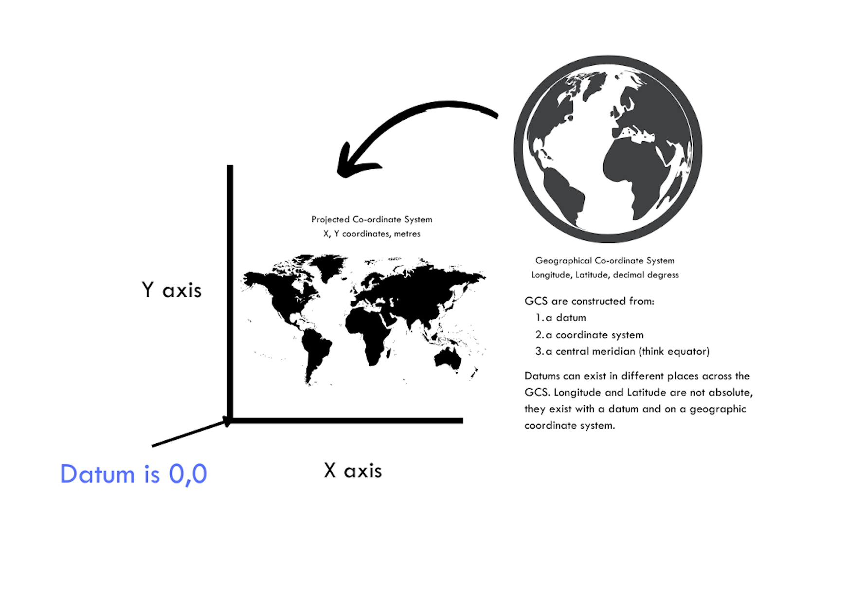
Geographic Co-ordinate Systems vs Projected Co-ordinate Systems
Geographic Co-ordinate system defines WHERE the data is located on earth's surface. A GCS uses a 3D spherical surface to define locations on the earth. It includes angular units of measurement e.g. decimal degrees like longitude and latitude, it has a prime meridian and a datum (based on spheroid). The GCS uses a network of imaginary lines (longitude and latitude) to define locations. This network is called a graticule.
Projected Co-ordinate System tells us HOW the data is drawn on a flat surface e.g. paper/computer. A PCS is defined on a flat 2D surface. It has constant lengths, areas and angles across two dimensions. A PCS is always based on a GCS, that in turn is based on a sphere/spheroid.
I hope this little image helps to show this a bit more clearly.
Before you start constructing a map it is important to consider which Geographic System is behind the projection and also you may chose to use different Projected Co-ordinate Systems depending on which part of the world you are interested in or if you are using a global scale.
These details will be important as you start to add ‘layers’ of data and integrate the data. If you find things don’t line up, it is always worth checking what co-ordinate system the data is coming from!